
Clogrennan Hill [Rossmore Hill] [Cnoc Chloch Grianain]
Good walks are even better shared.
Overview
Clogrennan Hill [Rossmore Hill] [Cnoc Chloch Grianain]
Overview
Nestled in County Tipperary, Clogrennan Hill stands at a proud 406 metres, offering hikers a pleasant blend of manageable trails and splendid views. The hike up is a delightful adventure suitable for moderate walkers, with a treat of panoramic vistas awaiting at the summit.
Geology
Clogrennan Hill showcases a striking geology of limestone and sandstone, prime examples of Ireland's rich geological makeup. The gentle erosion has created fascinating rock formations, which are a treat for both geologists and casual walkers alike.
Routes
The most popular route begins at Clonmore Village, stretching approximately 5 km. Expect to spend about 2 hours wandering through open fields and occasional rocky patches before reaching the loving embrace of the summit cairn.
Summit Features
At the top, you’ll find a sturdy stone cairn and a wooden summit post. Standing there, you can bask in the satisfaction of conquering the hill—don’t forget that all-important photo!
Terrain
The terrain is mainly grassy but has enough rocks and rough patches to keep it interesting. Be on the lookout for the occasional sheep who might have better things to do than move aside for you!
Views
Climbers are rewarded with spectacular sights of the Slieve Bloom Mountains and serene river valleys stretching below. Spring and autumn are especially visually rewarding, thanks to the vibrant colours of nature.
Hazards
Just a heads up, the rocks can be a bit slippery when wet, and you may encounter some persistent ovine friends on your path. Stay alert and enjoy their bemused stares as you climb!
Access
The nearest parking is in Clonmore itself, which is a convenient base to kick off your hiking expedition. If you prefer public transport, occasional buses from Tullamore can drop you off right at the village.
Facilities
Once you descend, pop into the local café for a well-deserved tea or coffee, providing the perfect end to your hiking escapade.
History
The name Clogrennan reflects the historical significance of the area. Often tied to local folklore, it remains an important locality that has brought joy to hikers and residents alike.
Conclusion
Overall, Clogrennan Hill is a delightful destination for hikers seeking a modest challenge coupled with rewarding views and a dash of local history. So, pack your gear, slap on some sunscreen, and enjoy the beauty of Tipperary!
Explore routes near Clogrennan Hill [Rossmore Hill] [Cnoc Chloch Grianain]
Public walks starting within 80 km of this hill. Nearby does not mean a route reaches the summit; check its map and access before setting out.
No public routes are currently listed within 80 km of Clogrennan Hill [Rossmore Hill] [Cnoc Chloch Grianain] on Walkmates. This does not mean there are no paths here. Explore the map and check local access information before planning a walk.
Route planning notes
These notes describe possible approaches, not verified navigable routes or permission to cross land. Check current paths, local access rules and conditions before setting out.
From Clonmore Village
A scenic route leading through grassy fields and heath, eventually ascending the gentle slopes of Clogrennan Hill.
Make a day of it, together
Find someone to share the walk with, or organise a day out along a route you like.
Hill facts and local notes
Classifications
Elevation
336m
1,102 ft
Prominence
228m
Coordinates
52.8132, -7.0101
S668740
OS Map
61
At the Summit
The summit features a classic stone cairn offering a perfect backdrop for that obligatory summit selfie. There’s also a wooden post marking the top, though it might not win any beauty contests.
Terrain & Geology
Clogrennan Hill is predominantly composed of limestone and sandstone, typical of the region's karst landscape. The intricate rock formations have been shaped by a combination of geological processes, enhancing its ecological diversity.
Views & Scenery
From the summit, you can spot the majestic Slieve Bloom Mountains, the River Barrow, and on a clear day, even the distant peaks of the Wicklow mountains. A feast for the eyes!
History & Heritage
Name Origin
Clogrennan is believed to derive from the Irish 'Cnoc Chloch Grianain', meaning 'hill of the stone of Grianan', referring to ancient narratives associated with the site.
Historical Significance
The hill has been a noteworthy landmark for centuries and holds significance in local folklore, often said to be a meeting point for ancient tribes.
Getting There & Facilities
Check current local access restrictions, parking rules and transport timetables before travelling. These notes do not confirm public access to the summit.
Parking
There is a small car park at the edge of Clonmore village, which serves as a good starting point for your adventure.
Public Transport
Regular bus services operate to Clonmore from larger towns like Tullamore and Portlaoise.
Nearby Facilities
While facilities are limited in Clonmore, there is a quaint café nearby to grab a cup of tea or a slice of cake post-hike.
Safety Information
Known Hazards
- Mildly slippery rocks during wet seasons, beware of sheep on the trails as they have little regard for hikers' schedules.
General Safety Tips
- Check weather conditions before setting out
- Carry appropriate clothing and equipment
- Let someone know your planned route
- Take a map, compass, and GPS device
- Carry emergency supplies: food, water, first aid kit, torch
Hills
Some common questions about the hills answered
Are there group walks up Clogrennan Hill [Rossmore Hill] [Cnoc Chloch Grianain]?
Many walkers use Walkmates to join or organise walks with others. You can check for group walks around Clogrennan Hill [Rossmore Hill] [Cnoc Chloch Grianain] through the maps
Are there other walkers around Clogrennan Hill [Rossmore Hill] [Cnoc Chloch Grianain]?
Activity varies by location and time, but Walkmates lets you see whether others have shared walks or shown interest in this area. Find other people through the walking friends search walking friends for Clogrennan Hill [Rossmore Hill] [Cnoc Chloch Grianain] search or of course create your own walk for Clogrennan Hill [Rossmore Hill] [Cnoc Chloch Grianain]
Can I organise a walk to Clogrennan Hill [Rossmore Hill] [Cnoc Chloch Grianain]?
Yes. If there aren’t any walks listed already, you can create a walk and make it available for others to join.
If you're signed up to Walkmates, you can create a walk to Clogrennan Hill [Rossmore Hill] [Cnoc Chloch Grianain].
How do I find a walk up this hill?
There are often multiple ways to walk this hill, depending on experience and route preference. Walkmates helps you explore walks and routes that others have shared.
Can I suggest a new route up Clogrennan Hill [Rossmore Hill] [Cnoc Chloch Grianain]?
Yes. You can suggest or create routes to share with others. Walkmates focuses on the social side of walking, so routes are used to help people organise walks and explore areas together, rather than as detailed navigation tools or route libraries.
Other uses really appreciate knowledgeable walkers sharing their routes. Share your favourite route to Clogrennan Hill [Rossmore Hill] [Cnoc Chloch Grianain] here
The is an error or something incorrect about this hill. How do I let you know?
We always strive to keep the information on Walkmates as accurate as possible. If you find an error, please let us know through the contact form and we'll aim to correct it as quickly as possible
Community Discussion
Comments
Location
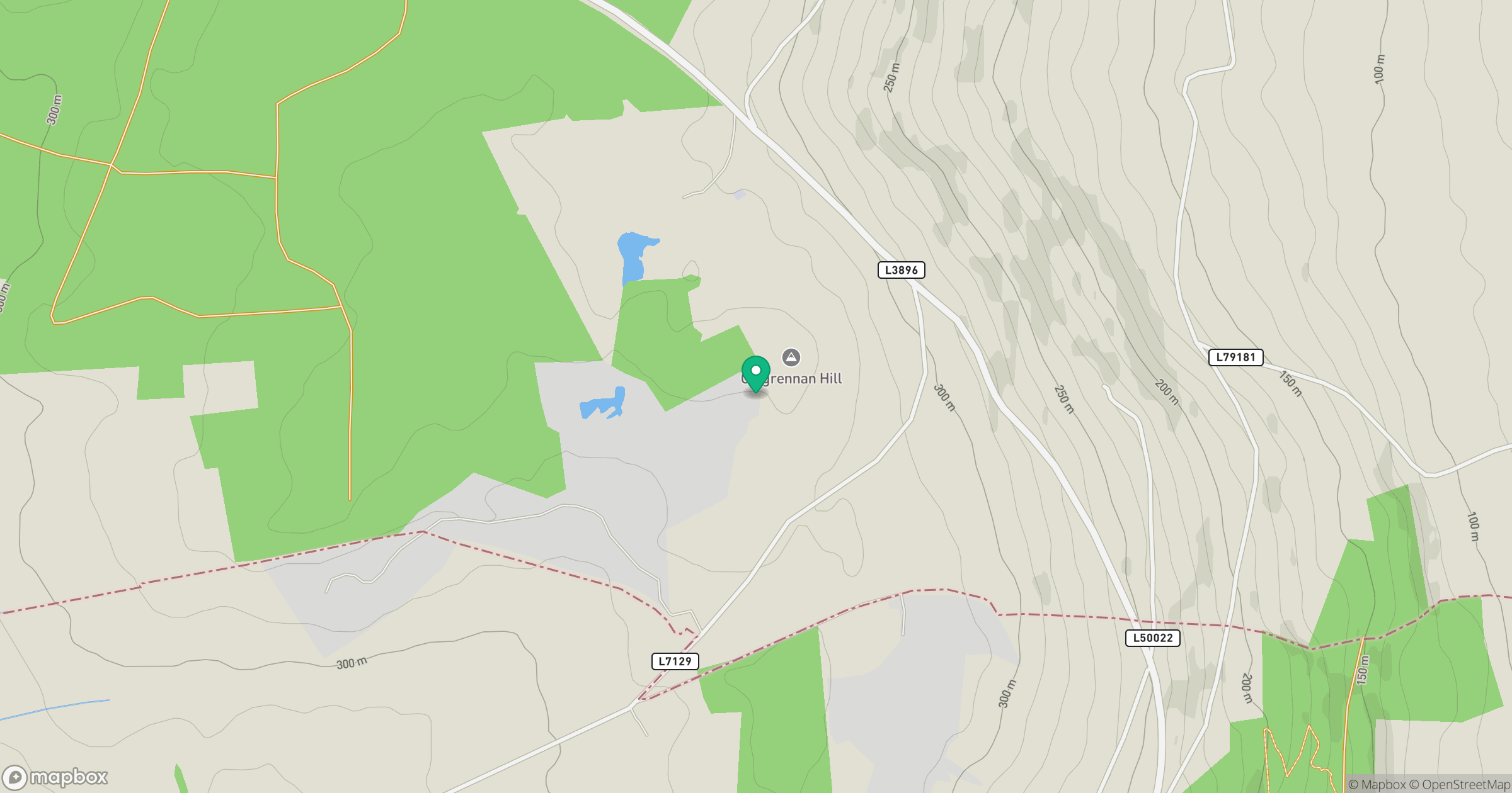
Grid reference: S668740
View on OpenStreetMapOpens a map in a new tab, centred on the hill.
Hills within 30 km
Straight-line distance, not a walking route or confirmation of access.
Fossy Mountain
332m
Croghan
365m
Knockmore
228m
Croaghaun [An Cruachan]
456m
Cullenagh Mountain [Sliabh Chuileannai]
317m
No comments yet. Be the first.